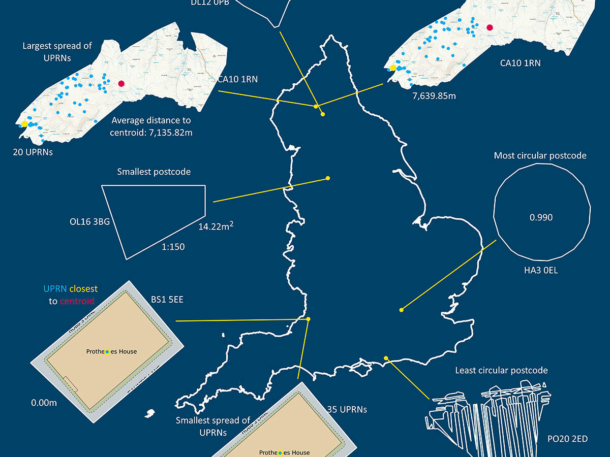
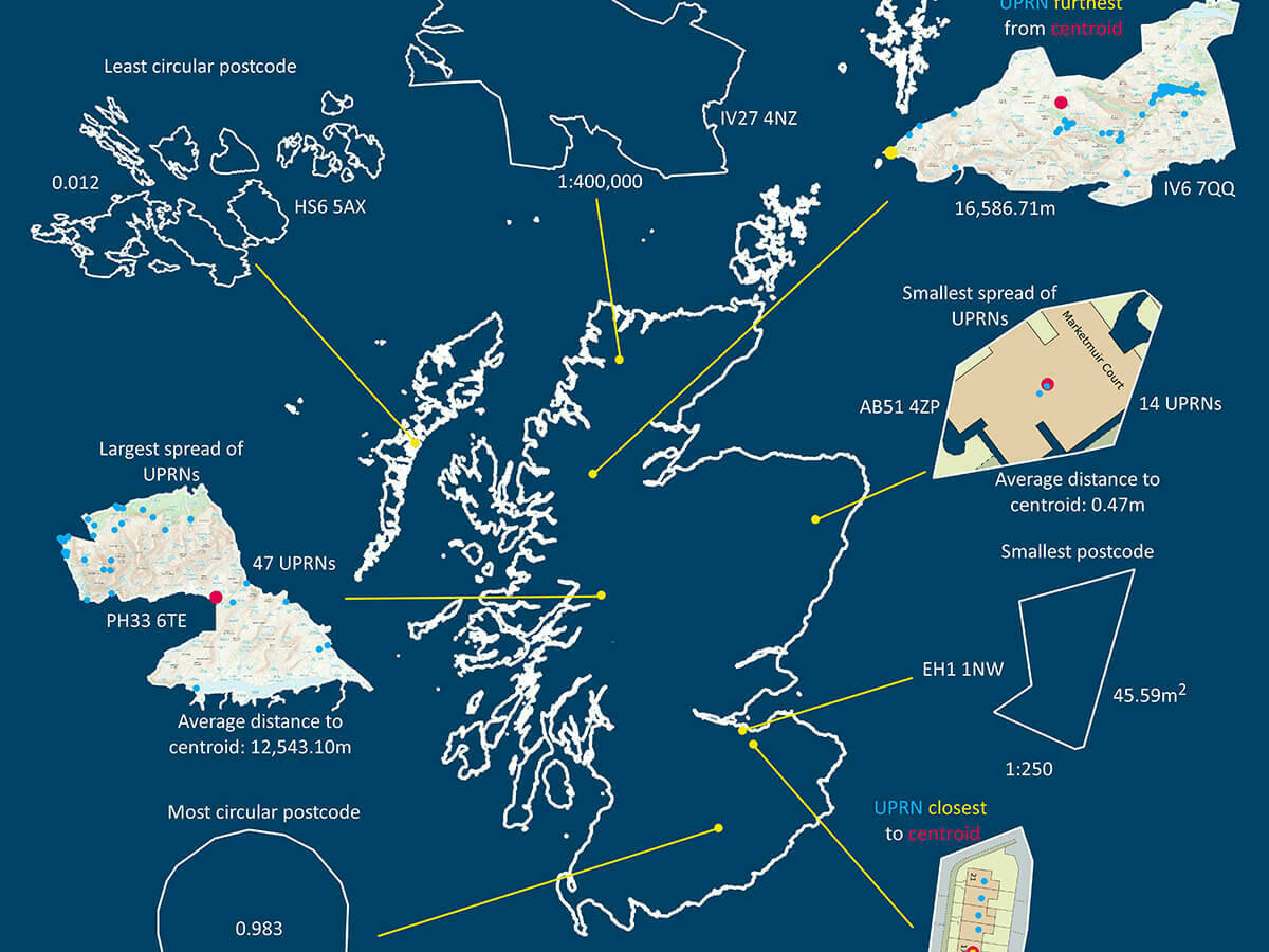
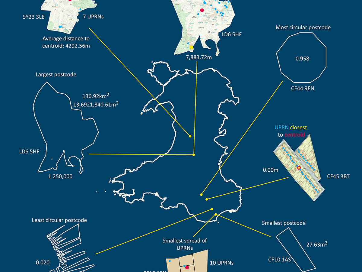
GeoPlace’s Data Insights Team analysed the spread of UPRNs and postcodes within England, Scotland and Wales to understand:
- Number of records
- Spatial relationship of records
- Distribution of records
The analysis was taken at a national level for England, Scotland and Wales, using predominantly the same method, although for England there was a slight variation to obtain the average distance to centroid. In this case, the analysis was undertaken at 9 regional levels and then an average of the averages taken due to processing power needed.
Methodology
- Review UPRNs and distance to centroid of postcode
- Remove those UPRNs not in the same polygon spatially – for a variety of reasons
- Exclude multipart polygons from analysis as skew the results
- Exclude vertical streets
The resulting analysis demonstrated that UPRNs offer more granular and accurate analysis than postcodes.
Download your poster here


