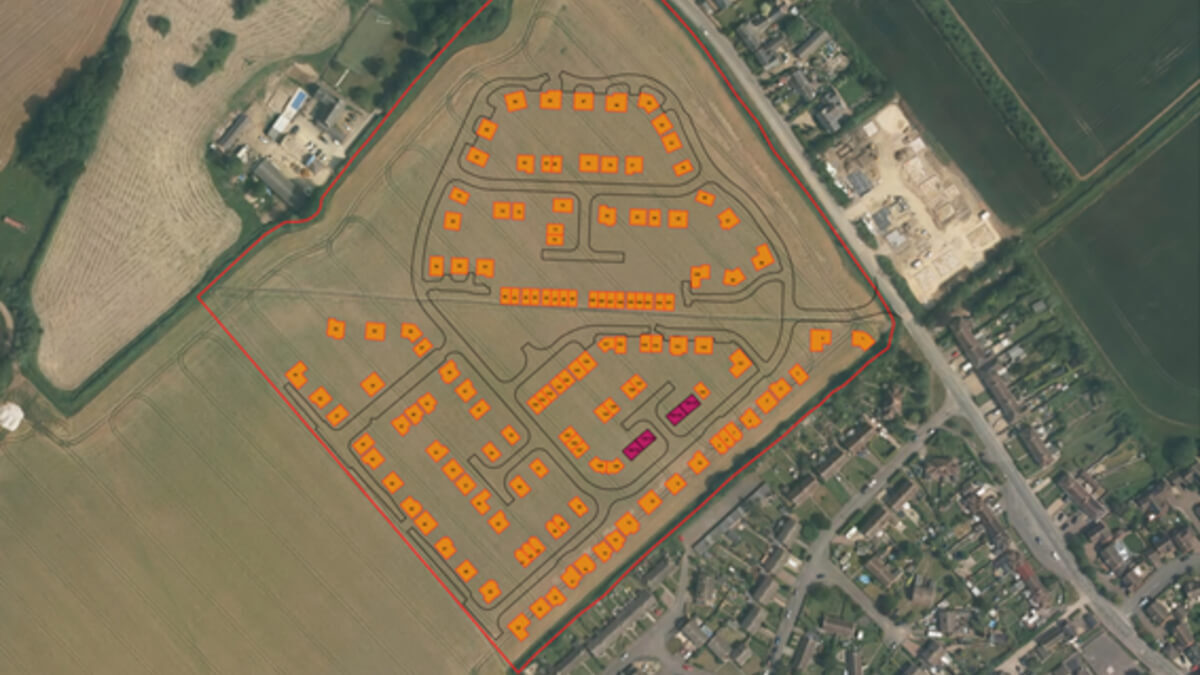
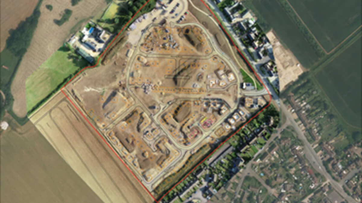
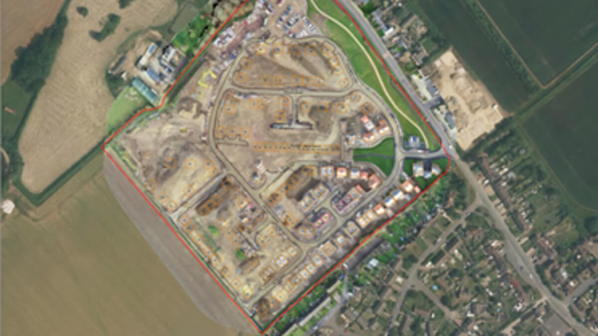
Milton Keynes Council has developed an innovative approach to monitoring development sites with the use of drone technology, enabling them to pre-empt citizen's needs.
Milton Keynes Council has developed an innovative approach to monitoring development sites. With the use of drone technology, it is using imagery to support and manage its Local Land and Property Gazetteer (LLPG) providing an effective and timely data collection solution.
Introduction
In Milton Keynes there are currently just below 5000 properties under development, across 82 sites, of which 36 are major developments. On average each site builds 3 new houses a week, roughly 150 houses a year. Currently 4,931 properties are undergoing the planning process.
Plan:MK the new local plan for Milton Keynes sets out ‘how' Milton Keynes will grow until 2031. With a minimum of 26,500 new homes to be delivered by 2031.
To underpin these developments, an efficient system of data collection is vital. Milton Keynes Council has introduced a drone to monitor developments, with the aim to improve productivity and efficiency for data management in relation to the LLPG.
Challenges
Due to the rapid rate of development, it's a challenge to keep the LLPG up to date with property completions. Often the LLPG Officer is informed through calls from residents of a new property being occupied and needing the address to be activated with Royal Mail. Additionally, base mapping for new development sites is lacking. A site visit will often confirm progress on the ground, with houses built.
If it is not clear when a property is complete this can lead to problems. If a house is not updated as being complete or "approved" in the LLPG, Council Tax will not be collected. This results in a loss of revenue and the risk residents will not receive the local services they are entitled to. With service planning difficult due to the lack of current data, it is hard to predict or organise e.g. waste collection. This can lead to a build-up of waste needing to be collected and unscheduled waste collection services.
Furthermore, site visits can take anything from half a day up to a full working day to complete, a time-consuming way of collecting data. On occasions officers are unable to access a site. In addition, officers from different services can end up visiting the same site, which may often be to an empty field. If no progress has been made, this is wasted resource and time that could better be used effectively elsewhere.
Finally, due to the rate of development in the borough, the councils Building Control service may not be aware of when bases or plots are laid out and when properties have been completed. Again, a challenge for a site inspection programme.

Solution
Milton Keynes Council has taken a proactive step in overcoming the lack of accurate data by using an efficient approach to tackle these issues with the use of a drone to monitor development sites. Through linking the data provided from the drone to the LLPG, a more complete and up to date image of the progress on sites is available as well as more accessible imagery reflecting the rate of development.
With the project still in development, there is currently one Civil Aviation Authority (CAA) registered pilot who operates the drone. The Phantom 4 RTK drone is used as it is specifically designed for producing highly accurate aerial maps as well as Real Time Kinematic imagery which is all linked in via satellite signal. Site boundaries are inputted into the controller by the pilot and the drone is flown for roughly 11 to 12 minutes across the site. In this time 300 images are taken providing an encompassing image of the whole site. The imagery produced has 1 to 2 cm resolution which is highly detailed (manned aerial photography provides around 12.5 to 25 cm resolution imagery). This delivers time savings in comparison to ground surveys, which can take up to one day.

Suitable weather conditions are needed to fly the drone. With expansion of the service and the purchase of additional equipment, a drone capable of flying in various environments and in night-time conditions will be considered.
Once the flight is complete the imagery can be viewed as 2D or 3D imagery, with the focus being on 2D imagery for use with the LLPG. GDPR has been considered and whilst the intention is that no personal data will be collected, measures are in place should this occur. Additionally, the use of the drone is in accordance with CAA regulations.
The imagery is shared with services across the council via My GIS the internal Corporate Mapping solution. With this, services can plan site visits with confidence. Useful for Housing Monitoring, currently with a three-month programme to visits, locations can be determined with increased accuracy, avoiding those where little progress has been made. Building Control can also schedule visits using the data from the drone, saving time, improving productivity and efficiency. Electoral Registration can see ‘complete' houses, using intelligence to verify applications for registration to vote. Advanced notice of waste collection is possible by Waste and Recycling as it is clear to see which houses are complete with the drone imagery.

Data from the drone is imported into an Open Source mapping system called QGIS, new roads are added, and colour is used to match addresses and streets, plot numbers and layouts are also included in this process. The information is then added into the council's Gazetteer Management Software. Once the building has a roof and is ready for occupancy the status of the building is changed from "provisional" to "approved". As a result, it is then clear to see which houses are eligible for Council Tax.
The imagery from the drone comes together and links in to the LLPG and UPRNs, the result, an up to date LLPG.
Milton Keynes Council has plans to be carbon neutral by 2023. The use of drones to monitor sites will provide an environmentally friendly way to collect data. With reduced car travel to sites and fewer visits required, through sharing data, eventually the council will remove the need for vehicles to site as the service becomes fully operational.
With the project being in its early stages, the focus currently is on monitoring development sites. Officers do see further potential use for the service including isolated emergency response, enforcement issues including fly tipping, creative material for specific council projects, flood management etc. The commercial potential of drone is also recognised by the team.
As the project is in the developmental stages, cost savings have not yet been identified, however the aim of the project is based upon a more effective and efficient way of working across the council, as opposed to monetary savings at this point.

Conclusion
Through innovative use of drone technology and applying this to the LLPG, Milton Keynes council are establishing an efficient and effective procedure for data collection. With the council's willingness to embrace new technologies and evolving its GIS offering to include drone mapping, the proactive approach of the service is helping Milton Keynes Council to maintain an accurate and up to date LLPG for the benefit of the council and its local community.
Contacts
Paul Brookin - LLPG and Address Management Officer, Milton Keynes Council, [email protected]
Gillian Smith - GIS Manager, Milton Keynes Council, [email protected]


