Steve Taylor is the Head of Systems, Data & Information Governance at Essex County Fire and Rescue Service. Here he discusses the importance of addressing to the work of the fire service.

Accurate addressing is absolutely vital to the Fire Service. When we respond to incidents we need to get to that location in very little time, and the great work that local authorities and GeoPlace do in maintaining accurate addressing enables us to do that. There is no doubt in my mind that accurate address data saves lives, probably every day.
But of course a Fire Service does so much more than just respond to 999 calls. We are out in our communities every day carrying out vital work to prevent incidents from happening, and helping to protect people before we arrive on the occasions that incidents do happen.

To put this into context, here in Essex we use address data around 64,000 times every year.
- We carry out 6,000 visits a year to people's homes within Essex as part of organised Home Fire Safety Checks
- We carry out 8,000 visits a year to business premises to check they are taking the correct Fire Safety measures
- We visit an extra 1,000 businesses a year that represent higher risk, whether that is Firefighter risk, economic risk, heritage risk amongst others
- We are consulted on 3,000 Planning or Building control applications a year
- We visit all 500 schools in Essex to offer talks on various subjects to young people
- We attend around 20,000 incidents a year
- We visit a massive 35,000 homes a year as part of community events based on either perceived risk or recent incidents
The UPRN (Unique Property Reference Number) is the golden thread of address data and is embedded into our systems, including our mobilising system and our Community Fire Risk Management Information System (CFRMIS). Local authorities work to keep the data updated, and that helps us to keep on top of changes in the built environment.
Being a former Custodian and Regional Addressing Chair myself, I've been able to bring some of that really important knowledge to Essex County Fire & Rescue Service and put in place some processes which I passionately feel help everyone.
In data terms, it is extremely important to keep our address records aligned as closely as possible with the local authorities' records. The moment we start to deviate from that information and change addresses in our own systems, problems arise and we are not keeping accurate data.
Every local authority employs an Address Custodian who is responsible for maintaining accurate data. That data is passed to GeoPlace where it is quality assured before then being passed to Ordnance Survey and, finally, to us in the form of a product called AddressBase Premium.
Local authority Address Custodians rely on something called "Address Change Intelligence" to do their jobs effectively. Often this comes from their own internal teams such as Council Tax, Non-Domestic Rates, Planning and Building Control, Electoral Services and so on. Those teams notify the Custodian of changes as they become aware of them, and like a well oiled machine the address data stays fairly accurate. I see the Fire Service as being another source of Address Change Intelligence, so when we become aware of a change in the built environment we let the Custodians know about it, and something I call the "Circle of Address Data" continues with all stakeholders having more and more accurate data.
Within our CFRMIS system we have locked down the ability to change most address fields. With the best will in the world most people who are accessing the system don't have a thorough understanding of how data is created and maintained by local authorities and could make damaging changes to it. If any of our colleagues spot a problem with any of the data we contact the local Custodian and let them know. Most of the time they make a change their end, it filters through via "The Circle of Data" and once again the data becomes more accurate for everyone.
A field which is of particular interest to us is what a Custodian would call the "BLPU (Basic Land and Property Unit) Classification". This tells us what type of premises we're looking at. This has massive benefits to us as we can identify different levels of perceived risk in our community. For example, a premises might have people sleeping there who don’t know their way around the building. We refer to this as "Sleeping Unfamiliar". If there were to be a fire or other incident there, there could be large number of people panicking and not knowing how to get out. We ensure that we regularly visit and inspect these premises so that such incidents are extremely unlikely, or if an incident does occur then the risk of death or serious injury is mitigated by safety measures.
In the future, the address classification field could help us to identify where there are high-rise buildings, and we're working with GeoPlace to take that idea forward (more about that later). Whilst they provide us with extremely high quality data already, they're also kind enough to listen when we point out areas that could be even better and are very willing to help.

We use premises classification, along with some other risk factors such as incident history in premises of that type, to assign a risk level to every non-domestic premises in the county. We have put into place an automated process so that when we receive updates about changes to the built environment, the risk level of premises changes accordingly, which then allows us to arrange inspections and audits. Quite frankly, without having this data from those dedicated professionals who work hard to maintain it, we would struggle to understand where our greatest risks are.
We currently receive changes to our addressing data every 6 weeks, and there are many changes in that time. We have developed a process that allows us to interrogate the detail of those changes, particularly their classifications. There are multiple areas of the Fire Service which can benefit from knowing this detail. Our operational colleagues who get called to incidents can now know about these changes before an incident happens. This means they can carry out risk visits to better understand the impact of a potential incident and how they would stay safe while they're saving life and property. Our Protection team can carry out audits to help businesses have the best fire safety processes, helping to keep the public safe. And our Prevention team can offer Home Fire Safety Checks to people, especially in areas that most need them.
Talking of changes to the built environment, these are all managed by both Planning and Building Control processes. These processes involve consulting with key stakeholders on the plans to ascertain whether they should be allowed to take place. Here in Essex we are consultees on both, so we get a great insight into what might appear in the county. We can give our advice and opinion on things that will affect our ability to Protect, Prevent and Respond. We’re working with local authorities to try and ensure the UPRN is used wherever possible in this area because, as I mentioned earlier, the UPRN is the golden thread that ensures everyone is referring to the correct premises. This won't always be possible with Planning Applications because most Custodians wouldn't create a UPRN until that application is approved, but certainly in the case of Building Regulations there should always be a UPRN present.
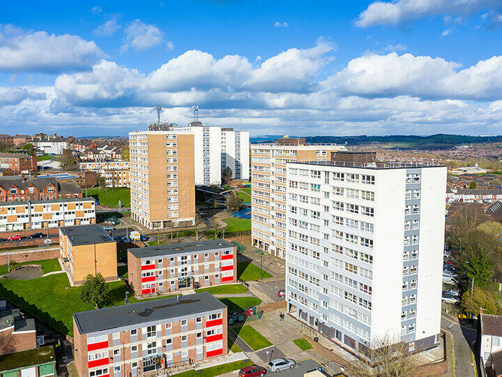
Another area that is of particular importance to us is the presence of high-rise buildings, particularly where they are blocks of flats. This has always been an area of great importance, but following the tragic events at Grenfell we are more determined than ever to ensure that we understand where these buildings are and carry out inspections of them to help mitigate the risks involved. So how do we know where to look? Well there isn't a single method at the moment, so we use a mix of things:
- Custodians often collect data about which floor a particular address sits on within a building, and aggregating those can tell us the total numbers of floors in that building.
- DHLUC provided us with a list of what they believed to be tall buildings and we then carried out a Building Risk Review project to inspect every single one, adding in others we knew about but weren't on the list from DHLUC.
- There are many products, not least of all Ordnance Survey's Building Heights data, which use laser technology to ascertain the height of buildings. Of course other physical aspects of the area can interfere with this, such as cranes on top of buildings, or large trees very close to buildings but it certainly can give us a good ‘head start’ which we can then narrow down with a site visit.
- Last but not least on this list would, of course, be local knowledge. The people we have working out there in the community, from Firefighters to inspecting officers, know their areas pretty well and, when we take that local knowledge along with the other sources I've mentioned we have a very good idea of where these tall buildings are.
As I mentioned earlier on we're working with GeoPlace to better understand their view of building heights and better ways to classify them. This will benefit emergency services certainly, but there are many other benefits of having a national dataset of this type. I'm very keen that good quality data should benefit everyone, and that we should all work together on getting the data we have to that level.
So in summary, the relationship between the Fire Services and the Addressing community (GeoPlace, local authorities and Ordnance Survey) is a vital one, and a strong one. Everything has a place and we all have important information about that, so sharing that knowledge for the benefit of everyone, and particularly to help save lives is absolutely integral to everything we do. We are extremely grateful for the hard work that takes place in that Addressing community and we want to return the favour by helping them have the best data they can have.....for the benefit of all.


