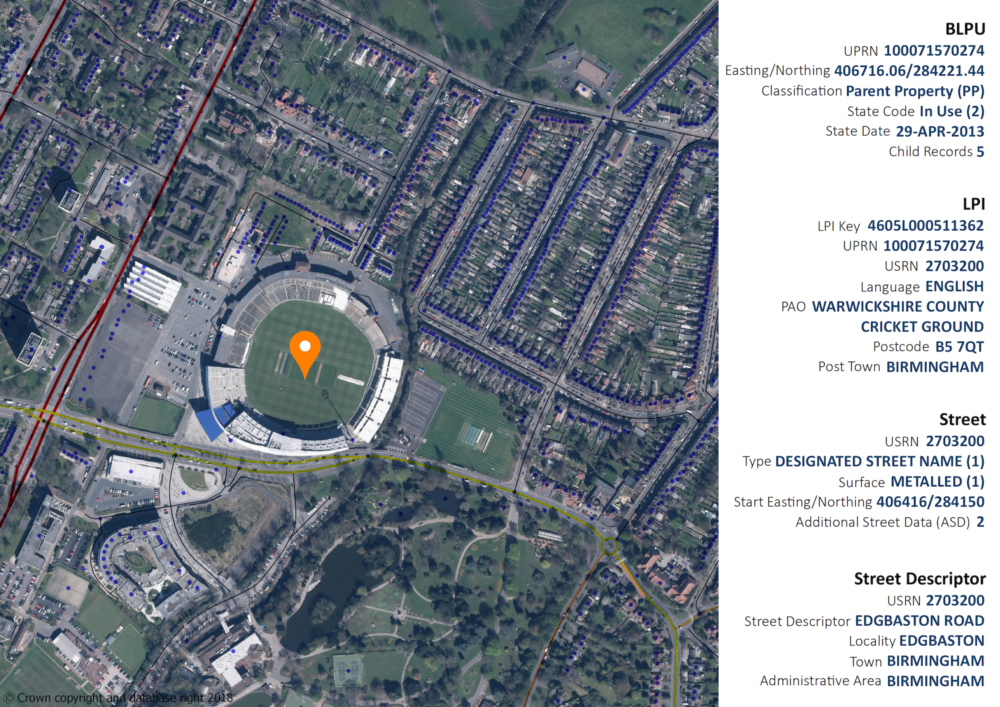
GeoPlace has responded to the recent discussion paper from HM Treasury on 'The economic value of data', highlighting the role of UPRNs and USRNs within a national data strategy.

GeoPlace welcomes the opportunity to comment on the discussion paper published by HM Treasury on ‘The economic value of data’.
We fully support the suppositions in the paper around the growing critical importance of high-quality data to the economy and firmly believe that national data infrastructures should be supported by government to enable wider access, interoperability and data sharing.
Having worked with users of address and street data infrastructures for the past twenty years, we have seen the benefits that they bring to service delivery and efficiency. Accordingly, our vision is for the ubiquitous use of the Unique Property Reference Number (UPRN) and Unique Street Reference Number (USRN) across public sector datasets so that no public-sector address appears without a UPRN and no street without a USRN.

Background
GeoPlace is a recognised global leader in developing definitive geographic address and street data. Over the past twenty years of working closely with local government, we have developed a national data infrastructure of address and street data.
GeoPlace is a joint venture LLP between the Local Government Association (LGA) and Ordnance Survey. We have a contractual relationship with every local authority in England and Wales to create and maintain a national data infrastructure of property which comprises of 42 million addresses. The resulting data is licenced to the private sector and made freely available to the public sector under the Public Sector Mapping Agreement (PSMA) as the AddressBase range of products and is also licensed to the private sector.
Similarly, we bring together street data from 174 local highway authorities and four other national organisations to create the National Street Gazetteer (NSG) which comprises of 1.39 million streets. Amongst other uses, the data is utilised on a statutory basis to underpin the coordination of street works through noticing and is an important part of OS MasterMap Highways Network.
Standards and statutory basis for the data
A standardised address format is mandatory to streamline services, reduce duplication, drive down costs and facilitate the exchange of data for service efficiency. GeoPlace’s data is compliant with BS 7666, the UK standard for addressing which was developed by government, industry and users working together.
Local authorities are the originators and definitive provenance of all addresses in the UK. Under legislation, local authorities are responsible for allocating new property numbers or names and street names to all new developments and property conversions.
Under the Traffic Management Act 2004 and New Roads and Streetworks Act, local authorities create and maintain the Local Street Gazetteer to manage and coordinate roadworks in the local area.
UPRNs and USRNs
A council’s Local Land and Property Gazetteer (LLPG) contains detailed information about every property with the council’s boundaries, including; its address, what type of property it is, whether it is known by any other name, its geographic coordinates, its postal address and a Unique Property Reference Number (UPRN).
Activities such as street naming and numbering, planning applications, building and environmental control, licensing, electoral registration, council tax and non-domestic ratings repeatedly bring local authorities in contact with land and property enabling thorough management of its lifecycle.
The UPRN provides a comprehensive, complete and consistent identifier throughout a property’s life cycle – from planning permission and street naming and numbering through to demolition.
The Council’s Local Street Gazetteer (LSG) contains detailed information about every street in the council including; what type of street it is, its coordinates and geometry, a description of it, information about its construction and reinstatement, any height, weight and width restrictions and traffic sensitivity status, and a Unique Property Reference Number (USRN) amongst other things.
UPRN and USRN ranges are centrally allocated and managed by GeoPlace. Working together, local authorities and GeoPlace are critical to maintaining data quality and GeoPlace is central to the continued provision of a definitive high-quality source of UPRNs and USRNs.
Open UPRNs and USRNs
GeoPlace is working with the Geospatial Commission, the Local Government Association, the Improvement Service (on behalf of Scottish Local Government), and Ordnance Survey to investigate opening up UPRNs and USRNs, together with their respective geometries, for the whole of Great Britain under OGL terms.
This investigation seeks to explore ways to ensure the protection of the integrity and authority of these identifiers, to provide both businesses and public-sector organisations with the confidence to continue to rely on these within their own products and services, without restricting their ability to use and benefit from them. The generation and management of the UPRN and USRN will remain in the ownership of GeoPlace.
Matt Hancock MP
Speaking at the GeoPlace annual conference, April 2016, the then Secretary of State for the Cabinet Office Matt Hancock MP said:
“The UPRN is the jewel at the heart of the addressing system. It links address data across a diverse range of systems and services. The UPRN facilitates greater accuracy and immediate data sharing and matching — delivering better services and better outcomes for citizens.”
Following the announcement of the development of the Data Strategy in June 2018, in an exchange of emails between the then Secretary of State for Digital, Culture, Media and Sport and GeoPlace, Matt Hancock said:
“My position as Secretary of State for Digital has only strengthened my view that UPRNs and USRNs (and their geometries) are crucial to our digital economy. I regularly hear start-ups and R&D projects asking for open address data, which they want to use for drone deliveries, autonomous vehicles and other innovations.
I see UPRNs and USRNs as the identifiers which unlock addresses and street names — the information that users can remember — by making it possible to link them to the machine-readable data that the robots and drones can use. This is fundamental to the growth of our location-based technologies.
I'm pleased that you've been involved in our work to open our geospatial data and want to thank you for your support for last week's announcement. I know we can count on you, together with the OS and the LGA, to work through the barriers to releasing these identifiers under the Open Government Licence. Our forthcoming National Data Strategy will rely on data infrastructure like the address that you curate and maintain. I'd be delighted if you'd work with my team.”
Driving interoperability and data linking
The UPRN and USRN facilitate electronic information exchange between datasets and can be used to tie other data, such as socio-economic data to a property.
The identifiers enable organisations to collate and share information based on a common reference, even if there are issues with other reference text associated with a record. Many technologies can be used to link and share data, including spreadsheets, databases, XML/GML schema and linked data – all of which can be underpinned by the use of these unique identifiers for spatial address information in Great Britain. Many suppliers have built APIs around the data.
Unique identifiers are a starting point for collecting and managing data, avoid the repetitive and costly task on on-going data matching and gain the network effect of multiple usages.
GeoPlace’s vision is to move past the current practice across government of building separate datasets and then batch-matching them - by working with other bodies to link data right at the start of the process – for example when a council tax valuation is made by the VOA or property sale is recorded by Land Registry
Using the UPRN and or the USRN means that organisations can continue to hold their address and street information in their existing formats but, by adding a single field containing the UPRN or USRN, it becomes possible to link matching records in different databases together.
Organisations are now using the UPRN to link pseudonymised personal data in the health sector, or to protect vulnerable people, making it possible to track usage of data whilst maintaining protection of personal data.
Further information
Examples of how organisations are using the UPRN and USRN to link datasets together to create intelligence either within their own organisation or multi-agency wide in our document ‘Linking people to places’ or in some of our case studies ‘Connecting data for better outcomes’


