
Embrace confidence and efficiency with DataVia. Add the National Street Gazetteer’s detailed street data to your GIS, web or mobile applications with ease and make location-based decisions with confidence.
DataVia is now on “Next Day Delivery”
Now all street changes submitted to GeoPlace by relevant authorities will be reflected in the DataVia API the very next day!
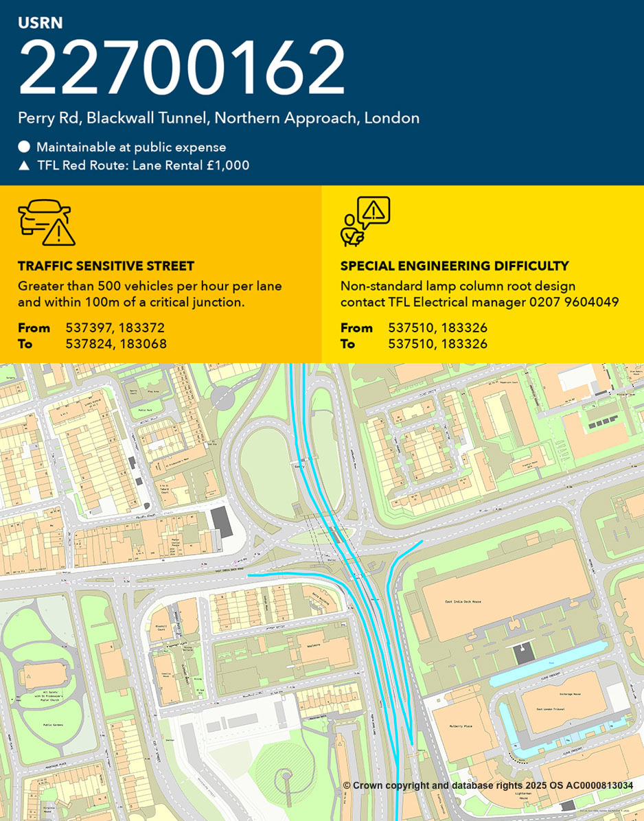
Navigating the complexities of on-site logistics can be a constant challenge.
- Get Your Plan Right the First Time: Identify parking restrictions, public and private streets, engineering difficulties or hazards, before work begins, minimising costly redesigns and delays.
- Plan Efficiently: Anticipate the need for wayleave agreements, optimise resource allocation and create comprehensive traffic management plans based on authoritative data on everything from maintenance responsibility to parking restrictions.
- Minimise Delays and Unplanned Costs: Proactive planning reduces the risk of unforeseen delays and associated expenses.
Select your organisation type below to see which NSG products are available to you:

Utilities

Contractors
In the UK, a contractor refers to companies and agencies that have been sub-contracted by a Statutory Undertaker to carry out specific development and highways work.

Local authorities
Access to the NSG is primarily limited to use by local government and those organisations that work on or around highways, as the definitive reference for co-ordinating street works and managing the road network.

PSGA
In the near future we hope to offer access to signatories of the Public Services Geospatial Agreement (PSGA) which incorporates providers of public services, central government and emergency services. For now however, access is given to local authorities, utilities and contractors.
DataVia products:
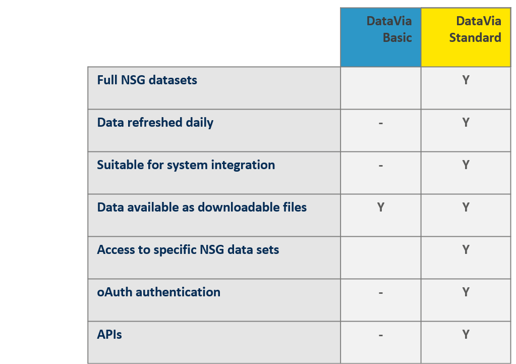
DataVia comes in two different options:
- DataVia Basic: a CSV Download Service only available to Statutory Undertakers & PSGA signatories. (Data refreshed monthly)
- DataVia Standard: a service bundle comprising; DataVia API, access to the CSV Download Service and a CSV API to the CSV Download Service. (Data refreshed daily)
Access to the NSG is restricted to the following types of organisation.
Which product is best for my organisation?
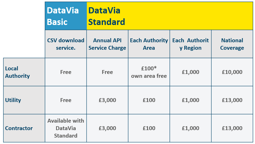
Product pricing:
External Link
DataVia
Go to the DataVia API by following the link below. If you aren't already registered, you can request trial access.
Street data
NSG CSV Download Service

Frequently asked questions:
- Q1 What is DataVia API?
- Q2 How do I access DataVia?
- Q3 Does using DataVia come at a cost?
- Q4 What data is included in DataVia?
- Q5 Can I use DataVia instead of downloading the CSV (Comma Separated Values) files?
- Q6 I am a contractor, can I use DataVia?
- Q7 I am a commercial transport organisation, can I use DataVia?
- Q8 Is there a way I can access DataVia as a member of the public?
Case studies:
Case study
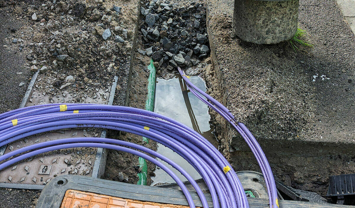
Freedom Fibre supercharges connectivity with DataVia
Freedom Fibre is using GeoPlace’s DataVia API to plan the rollout of its full fibre, high-speed broadband. DataVia provides real-time access to both public and private road data within Freedom Fibre’s internal design GIS, offering invaluable insights into potential wayleave costs for upcoming projects. As a result, Freedom Fibre has witnessed substantial improvements in service efficiency and customer support since implementing DataVia.